
At the beginning of 2023, I made a commitment to spend more time during the months of January and February hiking in new places. There are so many parks and trails in northern Virginia I’ve never seen despite having lived here for eight years off and on.
The new year is always a good time for me to get motivated about a goal, cheesily enough, and I think exercising outdoors in the cold feels better than during the hot, humid times as Virginia marches from late spring into summer.
When I returned from Christmas in California, my husband V was sick with COVID. I spent the week between Christmas and New Year’s acting for my supervisor during her well-deserved vacation from work, and handling various urgent situations that arose.
Then V and I had a quiet New Year’s at home. The first week of the year I had also taken vacation for Orthodox Christmas, but V still was not fully recuperated and felt wiped out. So I decided to make my leave a staycation. My goal was to go for a hike every day of my week off.
I set two criteria for my hikes. One, the hike had to be on a trail where I’d never been before. And two, I preferred the trail be no farther than 90 minutes away from home. I usually look on Google Maps or use the AllTrails app, but this time I used the Go Hike Virginia website to help me find new-to-me places.
So the first place I picked was the Mercer Lake Loop in Springfield/Fairfax Station, VA, about 14 miles west of our house. The trail is a mostly-paved 4.2 mile loop inside a 150+ acre park, which I reached by parking at the South Run Rec Center. After spotting the trailhead, I walked down along the South Run Stream Trail, which connected to the Mercer Lake Loop after about a half mile.

From there I followed the north loop straight and off to the left. I vividly remember strolling along at a good pace listening to Nine Inch Nails tunes from the 90s that filled me with high school nostalgia.
I hiked clockwise through some residential wooded neighborhoods until I reached the Mercer Lake Dam. That was about the halfway point and then I started winging my way back around. It was at about that point I knew I’d made a mistake by not bringing an extra pair of socks or any Compeed patches. I didn’t have so much as a tissue. My socks were damp and my hiking boots had started to rub the back of my right heel, then my left. The ground was wet and muddy in spots, and taking my boots off would not have been ideal. I’d underestimated how damp the air really was out there that day.
By the time I got back to my car, I was badly limping and the back of my heels were completely torn up, despite having broken in my Keen hiking boots almost three years ago. I’d planned to hit the drugstore on the way home to pick up a few necessary items, but my feet were so bad I just ordered what I needed for delivery and drove to my house in my socks instead. It was a nice, uncrowded trail in any case and my only regret is not managing myself better so my experience could have been less painful!

Frustratingly, I lost three days of the week being unable to wear *any* closed-toed shoes before I could get in my next hike. It was far too cold for sandals, even for me, so I was furious with myself for allowing my feet to get so messed up. Painting my heels with NuSkin, plastering on Compeed patches, layering my socks, and packing extra socks, bandaids, and even a spare set of boots, this time I was ready!
I drove about 30 miles from our house northwest to Great Falls, VA (near McLean and Wolf Trap) to hike at the Difficult Run Stream Valley Trail.
The entire trail is nearly 10 miles and encircles Great Falls Park alongside the Potomac and across from the C&O Canal National Historic Park, before extending in a westerly direction halfway to Reston.
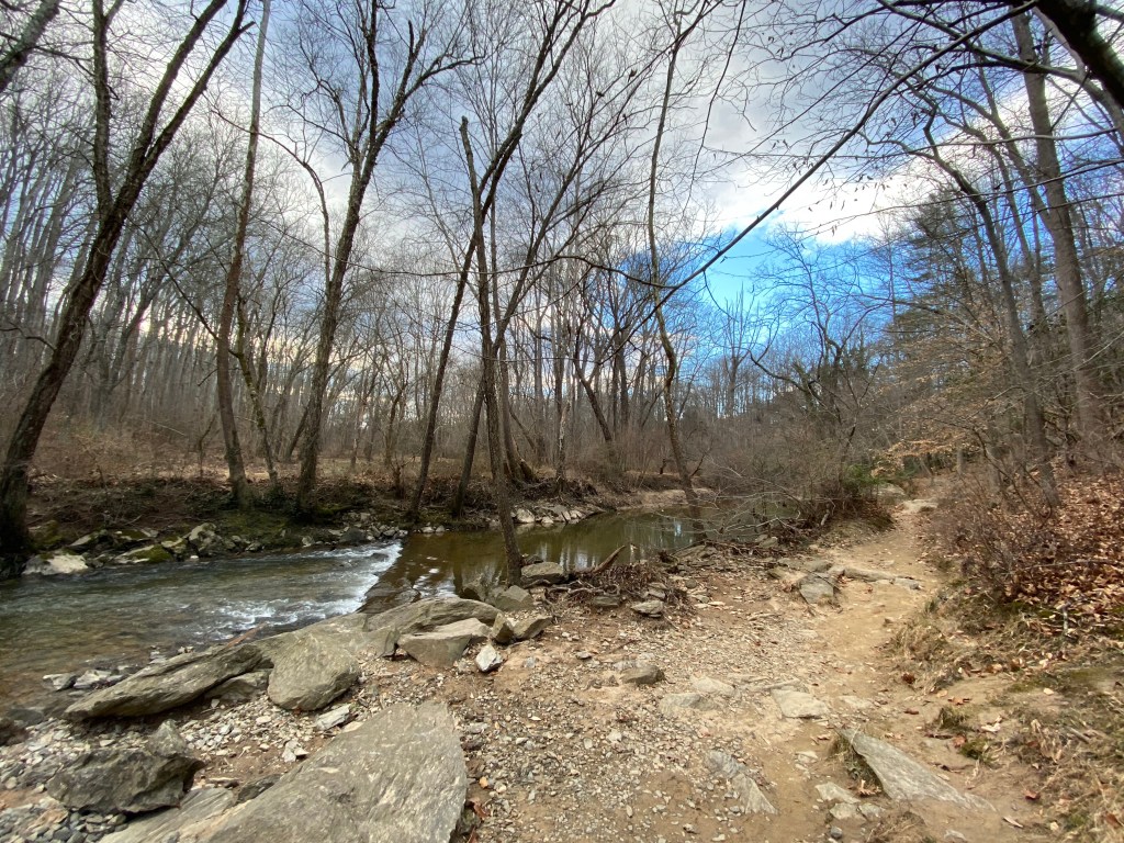
It hadn’t occurred to me with the recent weather that there would be so. much. mud, but I didn’t let it bother me. I walked for a couple of hours, crossing the stream and doing a bit more rock scrambling than I’m used to.

I did very little of the longer trail, but at least it got my heart pumping and it was a relief to have a change of socks and boots along the way. I also enjoyed photographing this trail and didn’t encounter more than a couple of other hikers in the section I kept to.

My next hike was in Alexandria just a few miles from my house, at Huntley Meadows Park. I’d ignored signs for Huntley Meadows in the past because I thought I’d already been there – I had posted photos on Facebook in December 2011 featuring V and I walking along its boardwalk.

But as it turns out, there are multiple sections of it accessible from different parking lots. I went to one of the parts I’d never been before. It’s the largest park in Fairfax County and at 1,500 acres is one of the DC metro area’s largest freshwater wetlands. Over 200 different species of birds have been identified here, and it isn’t uncommon to see otters, turtles, and even snakes during the warmer months.
During my visit, the temperature was less than 30 degrees Fahrenheit and I kept rubbing my runny nose with my gloved hand to try to warm it up. I tried to remember the silver lining: if the weather had been warmer, I would have had to drown myself in bug spray.
During this walk, I remember I listened to a combination of music and podcasts; I particularly remember listening, rapt, to a podcast outlining the tragic mystery of the 1982 Tylenol murders in Chicago. Every once in a while, the sound of a pileated woodpecker drumming away in the hardwoods would break through my self-imposed reverie.
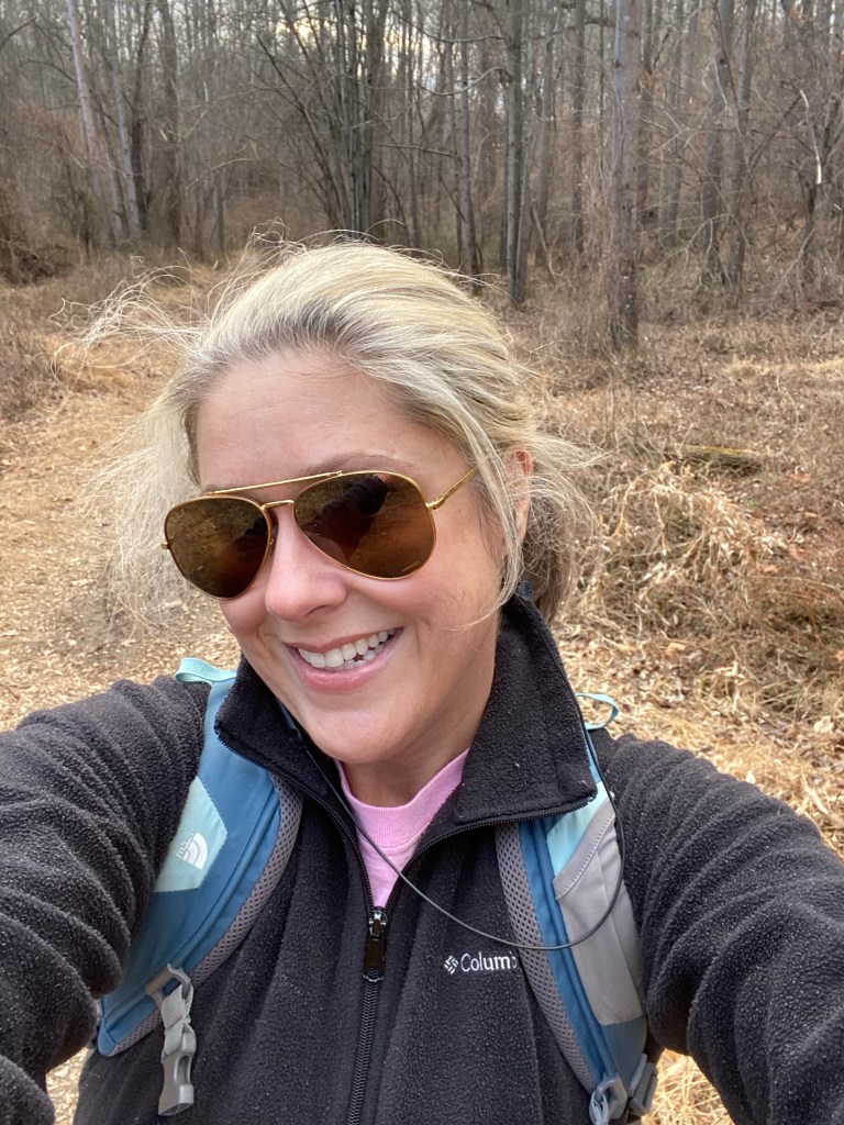
By early February I was ready to go for a hike with someone else, so when a college friend who has now lived in the area even longer than I have messaged that we should get together, we decided to cram a weekend afternoon walk in her neighborhood into our busy schedules.

Later that month as I waited for service on my VW to be done in preparation for a third (!) cross-country road trip to the west coast and back, I took advantage of having a few hours car-free to walk along Arlington’s Four Mile Run Trail. Eventually that spilled out onto the Mt. Vernon Trail, alongside George Washington Memorial Parkway. After more than an hour, I ended up at Ronald Reagan Airport and continued on a little farther north to Gravelly Point Park.

Located on the west side of the Potomac River, Gravelly Point is a great place to watch domestic commercial flights land and take off at Reagan. For many years we brought our out-of-town visitors there, and we also took the girls there for a picnic and to see the 4th of July fireworks when they were little. So this wasn’t a new place to me, but I was a little chagrined I hadn’t realized Four Mile Run and Mt. Vernon Trail connected by the airport (HOW long have I lived here??) and so that felt a little novel.
When I trooped back to VW to pick up my car three hours later and getting close to 18,000 steps on my Fitbit (thankfully still blister-free), I told the service rep where I’d been. “That’s far!” he exclaimed, shuddering and grabbing his coffee. “It’s not that far,” I replied, grinning. “And it feels good to walk in the cold.”

1 comment for “New Year, New Scenes”